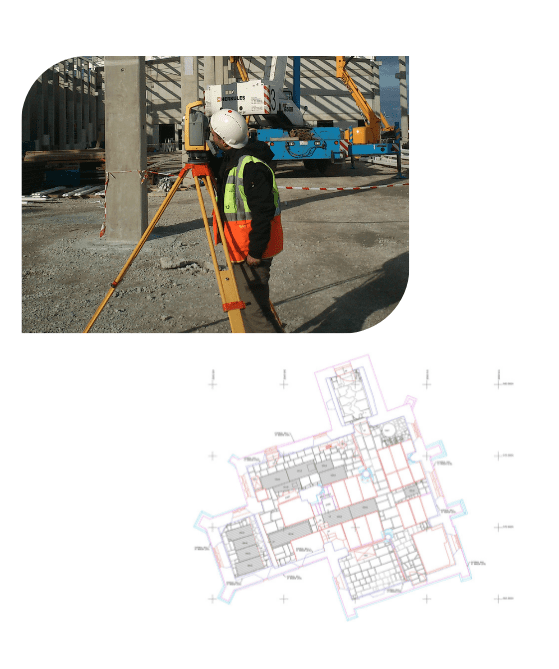
Discover a new level of understanding for your property with our Measured Building Surveys. Experience precision, detail, and accuracy like never before, with accurate floor plans, elevations, and sections that reveal the intricacies of your building.
Read More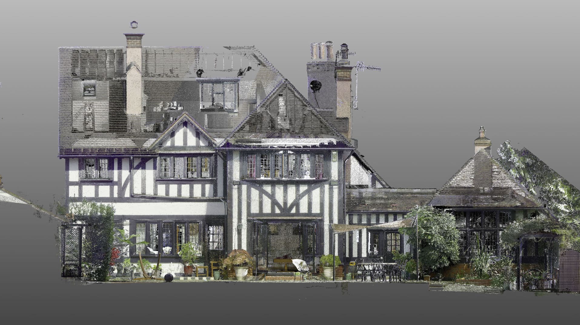
Topographical surveys provide precise and comprehensive representations of sites, land areas, or boundaries. These surveys exhibit meticulous scaling and detailing, showcasing both natural and manmade features, along with their respective elevations.
Read More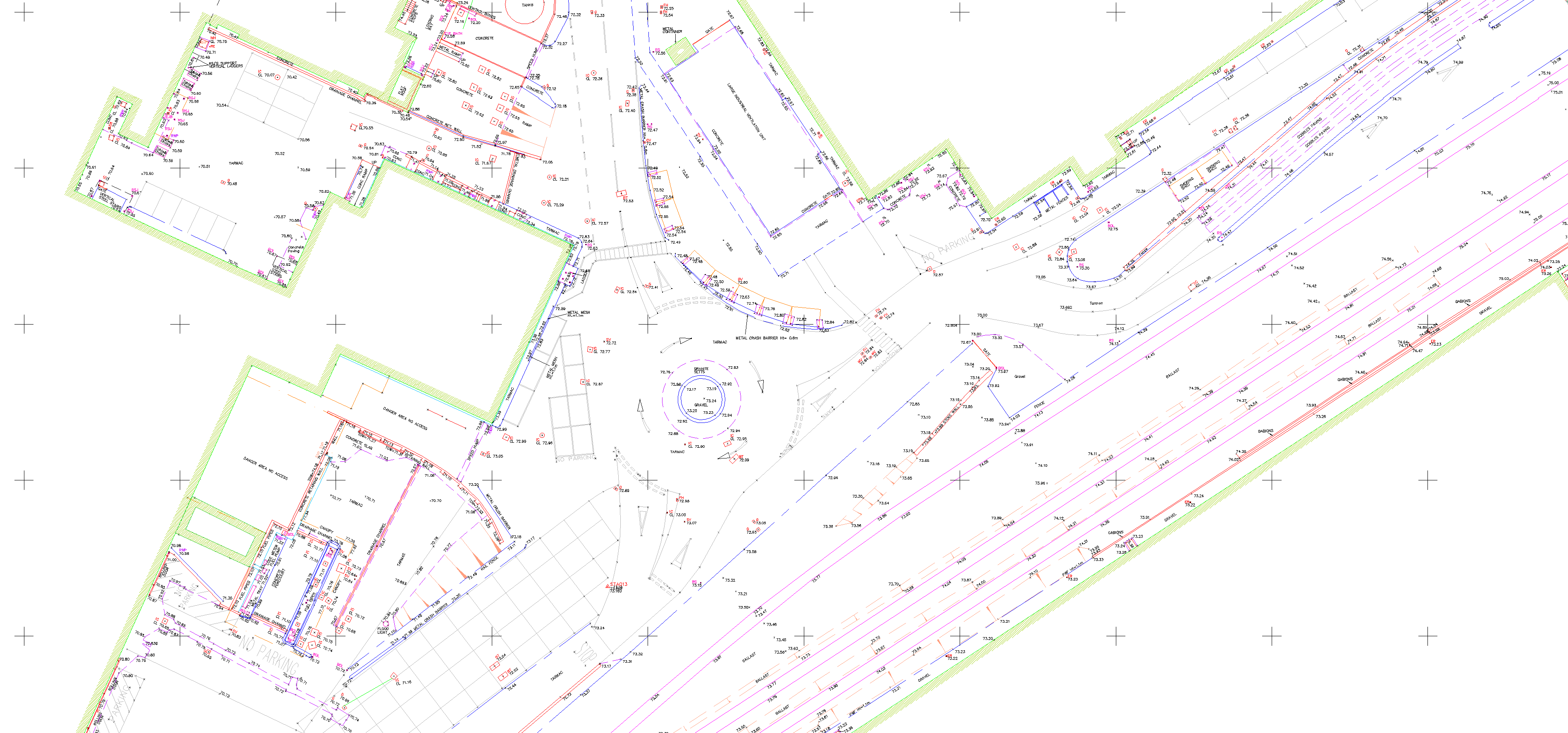
Uncovering concealed problems within your building becomes possible through Thermal Infrared Surveys. These surveys expose issues such as moisture, heat and energy loss, ventilation problems, missing insulation,foundation cracks, and structural concerns.
Read More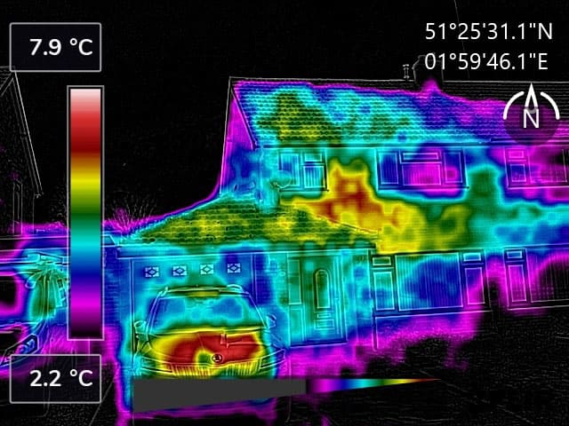
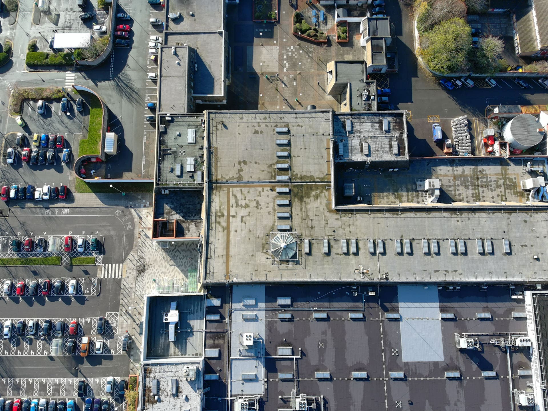
Drone surveying and inspections provide an efficient and cost-effective way to monitor a variety of projects with comprehensive results.
Drones can be used for a wide range of purposes, from structural assessments to roof inspections. With high-resolution imagery, they can provide detailed information about potential weak spots and cracks, as well as identify other structural issues. They can also be deployed to monitor progress on a construction site.
Read More